:: a river runs through it
 (Cross posted from Another Hundred Years Hence)
Maynila was born on the banks of the Pasig -established by people who were taga-ilog ("river folk") and yet 600 years later, we are so disconnected from our bodies of water.
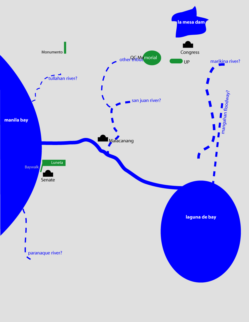
Notice my conceptual map - I know the Pasig connects the Bay to the Lake and I know it runs north of Makati and South of QC, San Juan and Mandaluyong - but I am, as I suppose the majority of us are, not aware of its eastward route. I have no mental image of how it meets the Laguna de Bay.
I have no mental image of the shores of the lake. I have a memory of driving around the lake -but not at the water's edge.
I know the San Juan River and Marikina River feed into the Pasig -but also have no mental image of where these rivers meet. I know the Manggahan floodway separates from the Marikina River at the Napindan Floodgates -and the floodway then runs straight towards the bay. I also know that the Tullahan feeds into the Bay and somewhere down south, the Paranaque River also feeds the Bay.
Why am I not aware of the paths of these rivers? Mainly because so few landmarks and public spaces are on the waterfront. Baywalk and the reclamation area face the bay. The Senate, the Cultural Center, the Folk Arts Theatre and the Coconut Palace are on the waterfront. So too the Quirino Grandstand in Rizal Park. The Malacanang is on the Pasig. The Jones, Macarthur, Quezon and the Ayala bridge over the river near Quiapo and Escolta.
Apart from that, very little of our urban life is connected to the water. So the rivers are dead -not just biologically, but also in our imaginations. The rivers do make their presences felt when they overflow their banks.
There are efforts to revive the Pasig and the return of the ferry will help -but until we reclaim the waterfront as public space, our waterbodies will live outside our conception of our metropolis.
(You can download a kmz file of the metro's major rivers on Google Earth Philippines or you can view it on Google Maps.)
posted by Urbano dela Cruz @ 8:38 PM
![]()
![]()

0 Comments:
Post a Comment
<< Home