:: Mass Transit I'd Like to See
 Here's something I'd like to see QC take on as a city project: a series of bus rapid transit / or tram (surface light rail) lines connecting employment and commercial centers in the city.
Click on the picture for a larger image, or see it on Google Maps. You can also download the kml file from Google Earth Philippines, via this link.
I've chosen mostly wide roads on routes that are not directly served by (a single) jeep or bus route.)
I see at least 4 lines.
- RED - UP to Quiapo via Quezon Ave. and Espana (potentially the most politically difficult because of exisiting jeep and bus routes -and the planned LRT line 7 -but I think QC should go ahead with it anyway)
- BLUE - From North Triangle to UP via Ortigas CBD and Eastwood/Libis
- YELLOW- Cubao to Eastwood/Libis Loop
- GREEN - Cubao to Munoz via Congressional and Visayas Avenues.
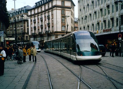
Pictures below show what they could look like.
 |  |  |
posted by Urbano dela Cruz @ 11:13 AM
![]()
![]()


0 Comments:
Post a Comment
<< Home